Oregon Coast Faces Severe Weekend Beach Hazards With High Surf and Sneaker Waves
A strong Pacific storm system is bringing dangerous surf, 50 mph wind gusts, and sneaker wave hazards to the Oregon Coast, prompting weather officials to urge beachgoers to stay off the sand.
In this piece
Severe beach hazards are impacting the Oregon Coast this weekend as a Pacific storm brings breaking waves up to 30 feet, gale-force wind gusts, and perilous…
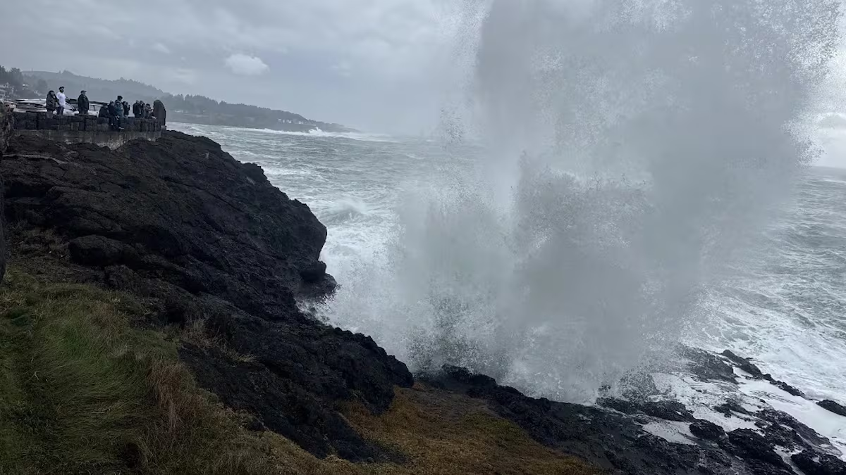
A robust Pacific storm system has triggered widespread beach hazards across the Oregon Coast, prompting forecasters to issue warnings for severe surf, sudden sneaker waves, and gusty winds over the weekend. The National Weather Service and emergency officials warned that ocean swells could generate massive breakers reaching heights of 25 to over 30 feet along exposed shorelines. Coastal residents and weekend visitors have been advised to exercise extreme vigilance as turbulent conditions sweep through the region.
According to coastal weather alerts, strong offshore winds packing gusts between 45 and 50 mph are expected to batter coastal communities and beachfronts. These gale-force gusts, combined with energetic deep-ocean swells, create an exceptionally volatile marine environment. Dangerous breakers are anticipated to crash over rocky outcrops, jetties, and low-lying coastal paths that are normally well above the reach of standard tides.
Among the primary threats highlighted by meteorologists is the elevated risk of sneaker waves—sudden, disproportionately large surges that can catch beachgoers unaware. Unlike regular swell trains, these waves build momentum far offshore and surge significantly higher and farther up the sandy slope than preceding waves. Their deceptive appearance often lures unsuspecting walkers close to the surf zone before sweeping them off their feet.
The danger is compounded by the Pacific Northwest’s frigid coastal water temperatures, which can induce cold-water shock and rapid hypothermia within minutes. Once pulled into the surf by strong backwash or rip currents, even experienced swimmers struggle to maintain flotation or navigate turbulent breakers. Emergency responders caution that sneaker waves can also quickly disorient victims and pin them against submerged obstacles.
Forecasters and state park rangers have also renewed urgent warnings about large driftwood logs scattered across Oregon beaches. Waves washing up the shore can lift and roll waterlogged logs weighing thousands of pounds in just a few inches of water. Anyone standing on, near, or behind these massive pieces of coastal timber faces severe crushing injuries or being trapped beneath shifting wood.
The convergence of heavy surf and high water run-up poses additional hazards to regional coastal infrastructure and natural dunes. High-energy breakers can accelerate beach erosion, carve out steep sand cliffs, and cause localized inundation along low-lying roadways and parking areas adjacent to beaches. Officials noted that rip currents will remain exceptionally strong and unpredictable throughout the duration of the storm system.
In response to the hazardous forecast, maritime safety agencies and park authorities strongly urged the public to stay entirely off exposed sandy beaches, rocky headlands, and jetties. Coastal visitors who wish to observe the storm surf are advised to do so strictly from designated, elevated vantage points safely situated well above the shoreline. Public safety personnel emphasized the universal maritime rule to never turn one's back on the ocean during active storm cycles.
Severe marine hazards of this scale are characteristic of dynamic Pacific frontal systems, which frequently channel energetic low-pressure centers across the ocean toward the Pacific Northwest. While dramatic wave action often attracts storm watchers to coastal towns, local emergency response teams often find themselves strained by preventable water rescues when visitors misjudge the sheer power of storm-driven swells.
Beach hazard warnings and surf advisories are scheduled to remain in effect through the weekend as the atmospheric system tracks across Oregon. Meteorologists expect swell heights and wind speeds to gradually subside early next week as the primary low-pressure center weakens and pushes inland. Until conditions moderate, emergency managers continue to plead with residents and tourists alike to prioritize safety and respect the immense power of the coastline.
Primary source: Google News Oregon. Newzly rewrites and structures source reporting for clarity; verify critical details at the original.