Potential for Heavy Rain and Flooding Returns to South Florida
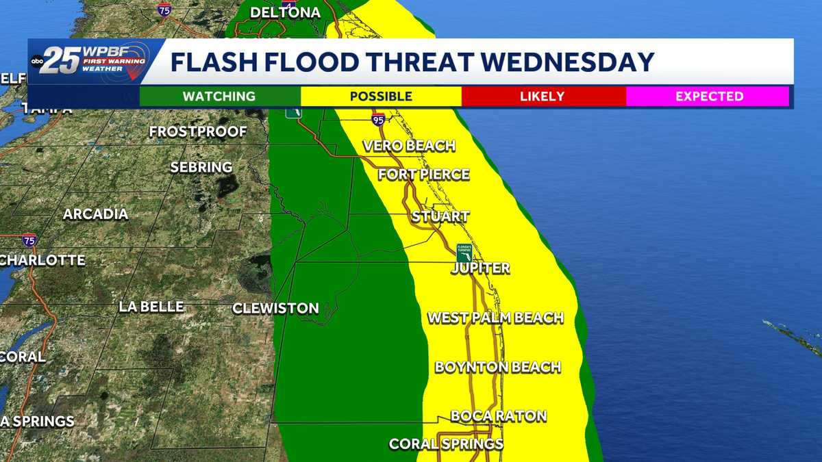
Meteorologists warn that South Florida faces renewed downpours and localized flash flooding over the coming days, as heavily saturated grounds heighten runoff risks in vulnerable communities.
In this piece
South Florida is bracing for another wave of heavy precipitation that could trigger localized street flooding across low-lying neighborhoods. With regional…
South Florida is once again bracing for the threat of heavy rainfall and localized flash flooding as an unsettled weather pattern settles over the region. Forecasts from WPBF and regional meteorologists indicate that deep atmospheric moisture will generate repeated rounds of downpours over the coming days. Residents across coastal and inland areas are being urged to prepare for sudden shifts in conditions.
The incoming atmospheric moisture is expected to deliver widespread accumulations, with localized storm cells capable of producing multiple inches of rain within short timeframes. Forecasters warn that training storms—weather systems where successive cells pass repeatedly over the identical footprint—could trigger acute inundation in low-lying zones. Even brief lulls between rain bands may offer limited relief if storms redevelop quickly.
A principal factor driving the flooding concern is the existing saturation of South Florida's soils following recent precipitation events. Because the ground has already reached or neared absorption capacity, additional rainfall cannot readily percolate into the subsurface aquifer. As a consequence, nearly all incoming moisture will be forced into surface runoff, accelerating the rate at which streets and swales fill.
The geographic realities of the region further compound flood risks during extended rainy periods. Flat coastal terrain, low elevations, and proximity to sea level mean that gravity-driven drainage mechanisms operate under narrow margins. When intense downpours coincide with elevated tide cycles, coastal canals and municipal outfalls face reduced discharge capacity, slowing water clearance.
Transportation corridors are expected to bear the brunt of the immediate impacts, with water pooling quickly along major thoroughfares, intersections, and highway access ramps. Commuters have been cautioned that standing water poses severe hydroplaning hazards and can obscure road hazards or stalled vehicles. Authorities routinely emphasize that motorists should avoid driving through flooded roads under any circumstances.
Local municipal agencies and public works departments are stepping up monitoring efforts across the region to safeguard infrastructure. Maintenance teams are inspecting key storm drains, removing palm fronds and litter that could obstruct intake grates, and verifying backup power for critical pumping stations. Water managers are also regulating regional canal levels where feasible to maximize stormwater storage capacity.
The recurring threat of inundation highlights the ongoing economic and logistical challenges that severe weather presents for South Florida communities. Persistent street flooding disrupts retail operations, strains transit services, and threatens ground-level properties with water intrusion. For property owners in historically flood-prone neighborhoods, successive bouts of standing water amplify the wear on infrastructure and drive up maintenance costs.
Emergency management officials advise residents to take basic precautionary measures around their homes and businesses ahead of the heaviest showers. Clearing domestic gutters, securing lightweight yard furniture, and maintaining charge on essential communication devices can help prevent localized property damage. Residents are also encouraged to review emergency supply kits and register for real-time weather warnings from local alert systems.
Meteorological models suggest that this wet, unsettled pattern will maintain its grip on the peninsula for several cycles before drier air begins to assert control. Forecasters note that the ultimate severity of any flooding will depend largely on where the heaviest rain bands stall. In the interim, South Florida residents are advised to remain vigilant, monitor radar updates, and anticipate intermittent travel delays.
Primary source: Google News Florida. Newzly rewrites and structures source reporting for clarity; verify critical details at the original.