Severe Weather Risk Accompanies Weekend Storms Across Oklahoma
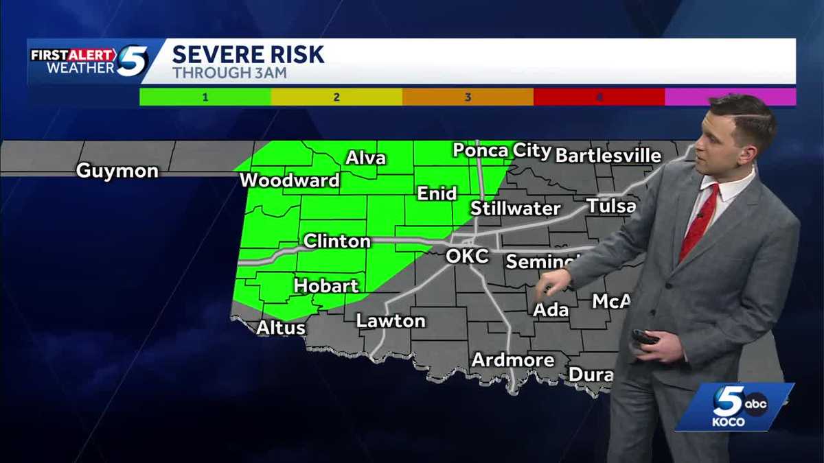
Showers and thunderstorms carrying a risk of severe weather are tracking across Oklahoma from late Saturday into early Sunday morning, prompting forecasters to urge overnight vigilance.
In this piece
A weather disturbance is bringing showers and thunderstorms with severe weather risks across Oklahoma late Saturday through early Sunday. Meteorologists advise…
A band of showers and thunderstorms carrying the potential for severe weather is tracking across Oklahoma, beginning late Saturday night and persisting into the early morning hours of Sunday. Regional meteorologists warned that the incoming system could produce localized hazardous conditions as it moves through the state.
According to coverage from KOCO, the weather pattern develops as an active atmospheric disturbance shifts into the Southern Plains. While precipitation brings beneficial moisture to portions of the state, atmospheric instability accompanying the front elevates the threat of stronger, convective storm cells during overnight hours.
Forecasters emphasized that nocturnal storm systems present distinct challenges for residents across Oklahoma. Because the most intense activity is projected to cross the region while many are asleep, officials and forecasters urged community members to ensure multiple avenues of receiving emergency alerts remain active overnight.
Severe thunderstorms during transitional periods across the Plains frequently generate hazards such as gusty straight-line winds, hail, and intense downpours capable of reducing visibility. While specific localized impacts depend heavily on exact frontal placement, meteorologists noted that elevated storm activity could create slick roadways and brief travel disruptions for overnight drivers.
Oklahoma's geographic position makes it a frequent corridor for rapidly shifting weather systems, where warm moisture from the Gulf interacts with cooler continental air masses. These dynamics frequently foster sudden storm organization along advancing boundaries, requiring continuous monitoring by regional weather trackers.
Emergency management personnel routinely remind travelers and homeowners that seasonal transitions demand heightened awareness during weekend storms. Securing outdoor furniture, parking vehicles under shelter where feasible, and maintaining charged emergency radios or mobile phones are standard precautions recommended across the state.
Agricultural and local utility interests also monitor such storm systems closely as they traverse central and eastern portions of the territory. Rapid lightning strikes and sudden localized wind gusts can occasionally down tree branches and strain local electrical infrastructure, prompting utility crews to prepare for potential service disruptions.
The timing of the line indicates that the primary convective energy should gradually push eastward and diminish as dawn approaches on Sunday. Behind the departing precipitation, cooler and more stable air is anticipated to filter into Oklahoma, gradually clearing skies from west to east through Sunday afternoon.
As the front clears the state later in the weekend, conditions are projected to settle, leaving behind variable temperatures and calmer atmospheric conditions for the start of the coming week. Meteorologists continue to analyze radar trends to evaluate remaining moisture and wind shear before issuing updated regional forecasts.
Local authorities and weather teams continue to urge Oklahomans to stay informed through trusted broadcast and digital channels as the situation unfolds. With nocturnal severe threats remaining unpredictable in intensity, ongoing vigilance remains the primary guidance until the system completely exits the area Sunday morning.
Primary source: Google News Oklahoma. Newzly rewrites and structures source reporting for clarity; verify critical details at the original.