Earliest recorded polar vortex weakening leaves UK snow outlook uncertain
BBC Science reports an unprecedented early weakening of the polar vortex, with forecasters unsure whether the shift will bring snow to the United Kingdom.
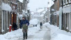
An unprecedented early weakening of the polar vortex is raising questions about the weeks ahead for UK weather, BBC Science reports. The outlet describes the change as the earliest weakening of the polar vortex on record and says experts remain uncertain about how it will affect conditions across the country, including the chance of snow.
BBC weather presenter Simon King has been explaining the development and the limits of what it can tell forecasters. The coverage frames the episode as unusual in its timing rather than as a settled forecast of cold and snow for the United Kingdom.
The polar vortex is a large circulation of strong westerly winds high in the stratosphere that, in the cold season, tends to keep the most intense Arctic cold bottled up near the pole. When that circulation weakens, the pattern aloft can become more disturbed. In some past winters, such disruptions have later been followed by shifts in the jet stream and spells of colder weather farther south, but the chain from the stratosphere to the surface is neither automatic nor uniform.
Meteorologists often watch these events because a weakened vortex can, over subsequent weeks, favor blocking patterns that steer milder Atlantic air away from parts of Europe and allow colder air to settle in. The same setup can also fail to deliver notable cold to the UK if the jet stream stays strong or if any cold pool is steered toward other regions. That is why a stratospheric signal is treated as a risk factor, not a guarantee of snow.
BBC Science’s account stresses uncertainty among experts about the practical impact on UK weather. The report does not establish that snow is imminent, only that the vortex has weakened unusually early and that specialists are still weighing what follows.
Timing matters in how these events are interpreted. A weakening later in winter arrives when the seasonal setup is already cold and snow is a familiar hazard. An early-season disruption occurs while daylight, sea temperatures, and the broader autumn-to-winter transition are still changing, which can alter how any signal reaches the surface. Forecasters therefore tend to wait for supporting signs in the troposphere before talking about a specific cold spell.
For the public, the immediate implication is caution rather than a confirmed snow outlook. UK winters can bring rain, wind, frost, or snow from ordinary Atlantic systems with no help from the polar vortex. A weakened vortex adds one more ingredient that models and human forecasters will track, alongside pressure patterns over the North Atlantic and the track of individual lows.
Snow itself depends on more than cold air aloft or a disturbed vortex. Surface temperatures, precipitation timing, and whether air is cold enough through the lower atmosphere all decide if precipitation falls as rain, sleet, or snow. Even a pattern that favors colder weather can produce little lying snow if systems track in the wrong place or if marginal temperatures keep precipitation wet.
King’s explanation, as presented by BBC Science, is aimed at that gap between a striking stratospheric headline and a usable forecast. The earliest weakening on record is a notable atmospheric event. What it means for roads, schools, and day-to-day weather in the UK is still being assessed.
What happens next will depend on whether the weakened vortex is followed by a clearer shift in weather patterns over the North Atlantic and Europe, and on how forecasters update their guidance as that evidence arrives. Until those links are clearer, the responsible reading of the BBC Science report is that an unusual early weakening is underway and that its effect on UK snow remains uncertain.
Primary source: BBC Science. Newzly rewrites and structures source reporting for clarity; verify critical details at the original.