How Gemini XII Astronaut Photos Sparked Early Earth Observation
When astronauts James Lovell and Buzz Aldrin orbited Earth aboard Gemini XII in 1966, their handheld photography helped catalyze the development of modern satellite Earth observation programs.
In this piece
NASA's Gemini XII mission concluded in November 1966 after demonstrating crucial rendezvous and spacewalk techniques. Beyond its engineering milestones, the…
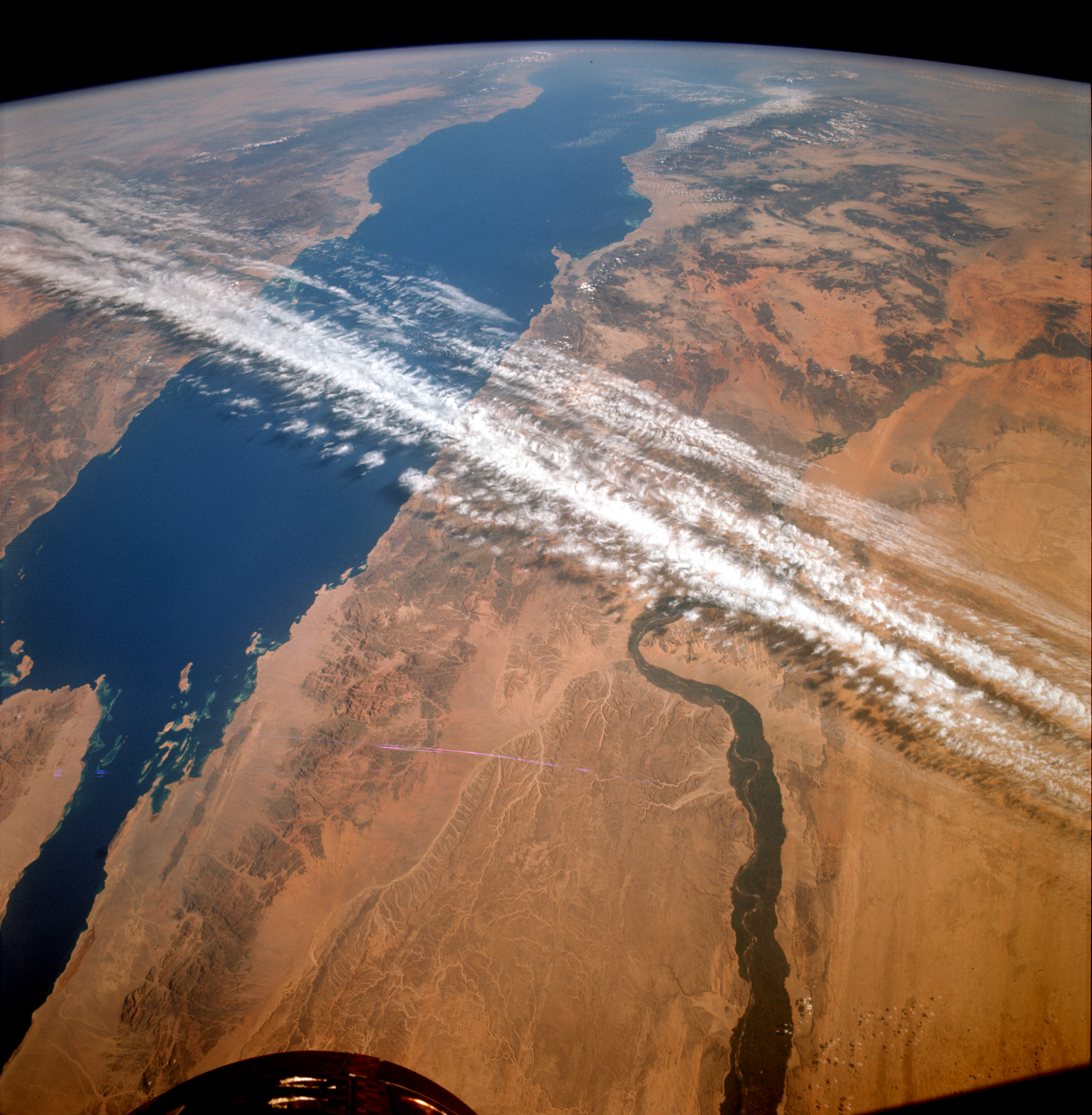
Astronaut photography captured during NASA's Gemini program, culminating in the Gemini XII mission in November 1966, served as a foundational catalyst for the modern era of satellite Earth observation. When astronauts James A. Lovell Jr. and Edwin "Buzz" Aldrin Jr. conducted their orbital flight, their mission objectives extended beyond critical flight maneuvers to include documenting the planet below with handheld cameras. The resulting high-resolution imagery provided scientists with an unprecedented view of terrestrial systems from space.
The four-day mission, which circled Earth from November 11 to 15, 1966, marked the successful finale of the Gemini program. The initiative's primary engineering objective was proving rendezvous, docking, and extravehicular operations required for human landings on the Moon. Yet as Lovell and Aldrin carried out their flight plans, their photographic surveys of landforms, oceans, and weather patterns yielded an immediate scientific dividend.
Prior to these human spaceflights, visual perspectives of Earth were limited to suborbital sounding rockets, specialized aircraft, and early meteorological satellites with comparatively coarse sensors. Using medium-format cameras loaded with color film, Gemini crews documented geological faults, river deltas, coastal shoals, and atmospheric dynamics with remarkable clarity. The vivid detail demonstrated that orbital viewpoints offered far more than aesthetic novelty.
The scientific utility of the astronaut photographs quickly attracted the attention of federal scientists and resource managers across the United States. Geologists, cartographers, and hydrologists realized that systematic imaging from orbit could revolutionize environmental mapping and natural resource management. What began as an experimental addition to flight itineraries rapidly solidified into an urgent case for dedicated civilian remote sensing.
The visual record helped mobilize federal agencies, most notably the U.S. Geological Survey under Director William T. Pecora. Impressed by the geographic insights revealed in the Gemini images, Pecora spearheaded efforts to establish an operational, space-based Earth observation system. In late 1966, the Department of the Interior formally proposed an Earth-monitoring satellite program, arguing that orbital surveys would transform agriculture, forestry, hydrology, and urban planning.
That institutional momentum culminated in the creation of the Earth Resources Technology Satellite program, developed jointly by NASA and the Department of the Interior. Launched in 1972 and later renamed Landsat 1, the spacecraft established the world's longest continuous space-based record of Earth's land surfaces. The satellite lineage directly traces its origin to the visual demonstrations produced by Project Gemini's crews.
Over subsequent decades, the experimental techniques pioneered by handheld orbital cameras evolved into complex constellations of multispectral and radar sensors. Today, civilian agencies and commercial operators rely on constant satellite streams to monitor climate change, map deforestation, track wildfires, and assess agricultural yields. The underlying premise—that monitoring Earth from space provides essential intelligence for planetary management—was validated during those early orbital missions.
Even as automated constellations handle the vast majority of environmental monitoring, astronaut photography remains an active component of human spaceflight aboard the International Space Station. Crew members continue to document dynamic Earth events, natural disasters, and nighttime illumination from orbit. Researchers routinely combine these human-directed observations with robotic sensor data to enhance ecological models and disaster relief efforts.
Nearly six decades after Gemini XII splashed down in the Atlantic, space historians regard the mission as a pivotal bridge between lunar exploration and environmental science. The operational milestones achieved by Lovell and Aldrin helped secure the path to Apollo, while their views of the globe helped build the architecture of modern remote sensing. As international agencies pursue future missions to the Moon and Mars, the perspective gained from looking back at Earth remains one of early space exploration's most enduring legacies.
Primary source: NASA Breaking News. Newzly rewrites and structures source reporting for clarity; verify critical details at the original.