Tropical Cyclone Xavier Launches Southwest Pacific Storm Season
Tropical Cyclone Xavier rapidly intensified into one of the strongest November storms in decades across the Southwest Pacific, fueled by exceptionally warm ocean waters and an active El Niño pattern.
In this piece
Tropical Cyclone Xavier launched the Southwest Pacific storm season with unprecedented strength, quickly reaching Category 5 intensity. Satellite observations…
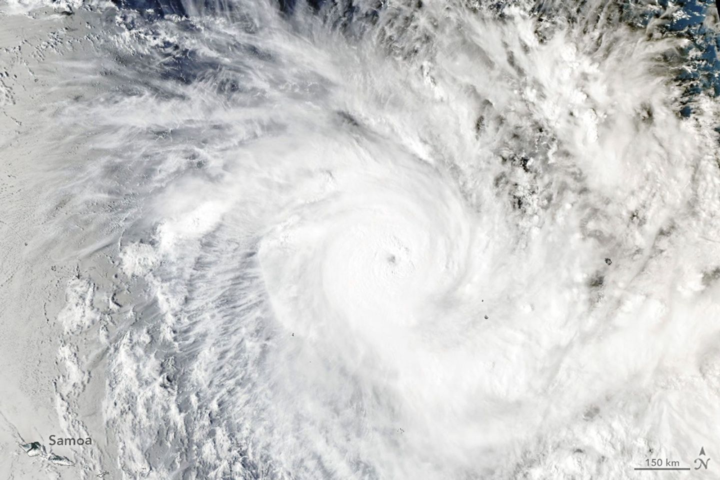
Tropical Cyclone Xavier has inaugurated the Southwest Pacific cyclone season with exceptional vigor, rapidly intensifying into one of the most powerful November storms observed in the basin in decades. Satellite observations highlighted by NASA's Earth Observatory captured the intense system churning across the open ocean, showcasing a well-defined eye and expansive spiral rainbands. The storm's rapid escalation marked an abrupt and remarkably energetic start to the regional tropical storm calendar.
The system initially took shape from a disorganized, slow-moving tropical disturbance situated northeast of Samoa and the Cook Islands. Specialized monitoring overseen by regional agencies, including the Fiji Meteorological Service, documented Xavier's swift transition from a broad area of low pressure into an organized cyclone. Favorable surrounding conditions allowed the vortex to consolidate quickly over open waters without encountering significant land friction.
Observations gathered by spaceborne remote sensing instruments, including the Moderate Resolution Imaging Spectroradiometer aboard NASA's Aqua satellite, revealed strong convective cloud tops and tight storm symmetry. Xavier swiftly climbed the meteorological scales, reaching Category 5 intensity on the Australian and South Pacific regional scale. With peak sustained winds estimated near 220 kilometers per hour (140 miles per hour), the cyclone attained the equivalent of a Category 4 major hurricane on the Saffir-Simpson wind scale.
Meteorologists identified exceptionally warm ocean waters as a primary driver behind Xavier's rapid intensification. Sea surface temperatures in the storm's path hovered near 29 degrees Celsius (84 degrees Fahrenheit), several degrees above the typical threshold required to fuel tropical cyclogenesis. These elevated temperatures provided an abundant reservoir of latent heat and moisture, driving continuous, intense convection within the eyewall.
Atmospheric conditions in the upper troposphere proved equally hospitable to the burgeoning storm. Xavier encountered very low vertical wind shear, a critical environmental factor that often hampers storm organization by blowing convective towers away from their low-level centers. With minimal shear present, the cyclone was able to maintain strict vertical alignment and channel latent heat into its core, accelerating pressure drops at the surface.
NASA researchers connected the supportive oceanic environment to broad planetary climate patterns, pointing to an active El Niño phase across the Pacific Ocean. The phenomenon is defined by an extensive tongue of warmer-than-average water stretching westward from coastal South America into the central equatorial Pacific. This shift in thermal structure frequently alters atmospheric circulation patterns, shifting favorable zones for tropical cyclone genesis and intensification across the southern oceans.
While the Southwest Pacific cyclone season officially spans from November through April, intense early-season systems of this magnitude remain historically unusual. Early major cyclones present serious logistical and emergency management considerations for low-lying Pacific island nations and regional shipping lanes. Even when storm centers stay over open water, expansive wind fields and prolonged swells can generate hazardous maritime conditions and coastal inundation hundreds of kilometers away.
The tracking of Xavier highlights the critical role played by Earth-observing satellites in monitoring vast, data-sparse oceanic regions. Polar-orbiting and geostationary platforms provide continuous meteorological telemetry where traditional land-based radar and surface weather stations cannot reach. These satellite datasets assist regional forecast offices in assessing storm position, structure, and intensity trends in near-real time, enhancing situational awareness for vulnerable island communities.
Meteorological agencies across the South Pacific continue to follow Xavier's path as the storm tracks across the maritime basin, issuing maritime alerts and advisories. Scientists and forecasters will also scrutinize the storm's evolution to better understand how larger climate drivers like El Niño influence early-season storm trajectories. For now, Xavier stands as a clear reminder of how rapidly ocean warmth can transform tropical systems into potent, high-end cyclones.
Primary source: NASA Breaking News. Newzly rewrites and structures source reporting for clarity; verify critical details at the original.